Skip to content

Our challenge

Robots mapping for robots. Fast, cheap, accurate.

Our vision

The future of mapping is robotic mapping, where robotics, cartography and navigation/geodesy meet. In the long term, we envision fleets of low-cost, autonomous, electrically-powered, mobile mapping systems (MMS) collecting geodata in a massive, continuous yet inconspicuous way to produce HD maps. We also envision AI as a core component of HD map processing engine to deal with huge loads of geo-data, collected daily/weekly and worldwide. In other words, robots mapping for robots.

GAMMS is a mapping robot plus a post-mission mapping software and enhanced by Galileo enabling a faster production of HD maps. 

GAMMS proposes a balanced method for more frequent base map production at lower costs due to the use of Galileo, the elimination of the crew of MMS, the automation of map elaboration, and less costly/risky massive update rates. 

We leverage Galileo differentiators resulting in higher trajectory precision/accuracy/reliability both in real-time (vehicle guidance) and post-process (generation of the HD base map). This is the first time that Galileo unique features will be used, among other techniques, to produce quality certified maps.

Our mission

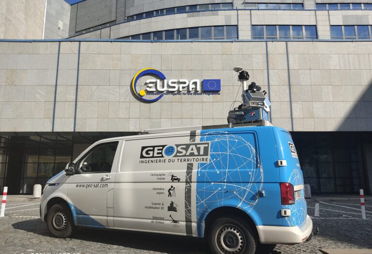
The overall objective of GAMMS is to develop an autonomous terrestrial mobile mapping system (AMMS),
based on the tight integration of

More specifically, we aim at developing an advanced prototype (TRL 6 to 7) of an autonomous terrestrial mobile mapping system –a mapping robot– based on an already existing Level of Automation 4 (LoA-41) AV for cm-level accurate and certifiable mapping to serve the needs of High Definition (HD) maps for autonomous vehicles.

Our solution

Our result is the production of high-definition, multi-purpose and accurate maps in a much faster and cheaper way than today. 

Ultra-safe navigation

(real-time) of autonomous vehicles (terrestrial and other).

High-accuracy trajectory determination

time, position, velocity and attitude of mapping
sensors (post-processing). 

Certifiable and traceable

high-quality maps amenable for terrestrial autonomous vehicles and other types of unmanned vehicles.

Affordable and frequently updated

base maps for further continuous map update.

Galileo for HD maps

Level of Automation 4 Autonomous Vehicles require HD maps to operate safely. HD maps are significantly more detailed, accurate and reliable than conventional navigation maps. These maps shall be cm-level accurate and day- to week-updated. 

Galileo and its services make a significant difference with respect to the rest of GNSS open services when it comes to trajectory determination for AVs, HD maps and cm-level accurate cartography. The Galileo differentiators and its new free-of-charge services enable high-accuracy ubiquitous outdoor trajectory determination for different applications. The fact that the HAS will be open and free of charge eliminates barriers to high-accuracy navigation and positioning. Also, open free-of-charge Navigation Message Authentication (NMA) eliminates barriers to trustable navigation and positioning.

In other words, the impact is the result of combining the technical superiority of Galileo over GPS and GLONASS and the free-of-harge and open-service nature of the NMA and High Accuracy Services (HAS).

Play Video

Our methodology

2021
Kick-off
GAMMS launched

GAMMS internal mechanisms get triggered.

2021
Iteration 0
GAMMS unitary development

Surveys of technology, market and user requirements

2023
Iteration 1
GAMMS demonstrator

The GAMMS demonstrator will be developed and tested in the first field campaign. This demonstrator will deliver the first version of a
new HD map and a certification procedure for HD maps. 

2024
Iteration 2
GAMMS prototype

Iteration 2 will reproduce iteration 1 to target the GAMMS prototype testing (second field campaign).
Another HD map will generated and certified using iteration 1 procedure.

2024
Wrap up
GAMMS conclusion

Results and contacts are wrapped up, the project closure is formally documented.

Considering the many innovative aspects of GAMMS, its application-oriented nature and its tight schedule, the project work plan will be resilient.

We propose an iterative-incremental approach that structures the project in three main phases or iterations plus an initial short phase (project launch) and a final phase (project wrap up).

In total, the work in GAMMS will be carried out in eight work packages.

The main objectives of this WP are: 

• Project technical/administrative overall coordination, project reporting and quality management.
• Innovation management.
• General and/or specifc awareness management through communication activities.
• Information to EU GNSS stakeholders like the European Space Agency (ESA) and the GSA.
• Set-up and maintenance of the project Document Management System (DMS) and webpage.

The main objectives of this work package are: 

• Identifcation of realistic AMMS end-user requirements.
• Analysis of the state of the art of GAMMS technologies.
• Update on the potential markets for the GAMMS concept.
• Feasibility analysis: trade-ofs between user requirements, technology potential & market trends.

The goal of this work package is the definition of the high-level AMMS system architecture (hardware and sofware) and its documentation in the corresponding Architecture Design Document (ADD). This package serves as a harmonisation/coordination effort between individual technical developments. At the end, the ADD shall cover all components of GAMMS: the AV, the MMS, the MLS, the Galileo receiver, and the trajectory, determination sofware.

This is the core technological work package of the project as the existing technology of the partners will be modified and adapted following the ADD specifications to the point where WP5 (System Integration) starts. More specifically, the WP contains a number of design and development subWPs where the core technology RTD partners will work in parallel. For this goal, three iterations are proposed:

  • Iteration 0 (Unit-level) will prepare individual components
    in view of ADD and early identifcation of conceptual/design mistakes and weaknesses.
  • Iteration 1 (demonstrator-level) will target the readiness for the first test campaign, in which all sub-systems will be in place.
  • Iteration 2 (prototype-level) will mostly be based on refinement of the components, inheriting the lessons of the past iterations and targeting full capabilities. Geonumerics will lead this package in their natural role of intermediary (input from MMS, output to AV, integration with Galileo and VDMs, etc.)

Integration at GAMMS deals with the incremental and sustainable agglutination of the manifold of sub-systems that play a role in the GAMMS workfow, both for hardware and sofware elements. There are specific goals for the different phases of integration. Clearly, iteration 1 and 2 will tackle the readiness of the GAMMS to be used in the first and second test campaigns (note that Integration runs in parallel to test planning), while iteration 0 will consist on an “integration statement”, by which all sub-systems will be evaluated to estimate its “readiness for integration”.

Triple-iterated testing and validation is the cornerstone of the iterative-incremental project management approach of GAMMS. The concept and its implementation will be tested [at least] three times, once atomically and twice in feld campaigns. By doing so, we detect concept, architectural, design, and implementation flaws as soon as possible, we keep the development “tension” at reasonable levels, and and we force the procurement of related technology and components as soon as possible.
Besides retroftng the project itself (results will trigger development refinement), this WP will yield outcomes to WP7 seeking the awareness rise of the project, and foster the interaction with the advisory board and, in general, the targeted markets. This shall happen before, during and after the first and second test campaigns. Thus, GEOSAT will lead, strongly supported by Geonumerics for technical results and including support from ENIDE for market connection.

The main goal of this Work Package is to develop the market of GAMMS in Europe and worldwide in order to generate HD maps service contracts shortly before or right afer the end of the project. These contracts shall generate the resources for the further development and marketing of the AMMS technology and services. An essential aspect of this WP is to continuously watch the evolution of the drivers of the highly dynamic HD map market. For this purpose, the consortium (lead of ENIDE, supported by GEOSAT) has to analyse the market, to contact representatives end users of AMMS services and derived products to show them the results of the preliminary tests and, hence, improve the preliminarily proposed business models.
It is also the goal of this WP to explore the regulatory AV operation framework and to follow the evolution of the freedom-to-operate framework. This activity will be lead by ENIDE with a strong support from GEOSAT, Sensible 4, and Geonumerics.

The objective is to ensure compliance with the ‘ethics requirements’ set out in this work package.