GAMMS at InterGeo
Gamm’s project gets noticed as its project partner the EPFL receives the 1. first prize in the PhD category of the CLGE Young Surveyors at InterGeo 2022!
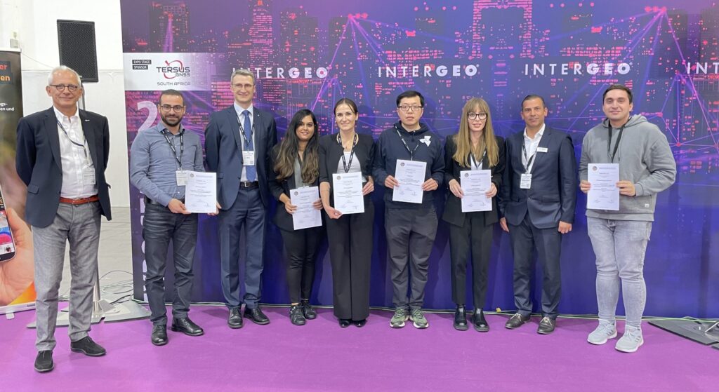
The Awarding Ceremony, which was the final stage, of the CLGE Young Surveyors’ Contest of 2022 took place today at INTERGEO in Essen (DE). Out of 36 applications, the CLGE Vetting Committee of the CLGE Young Surveyors’ Contest selected the 12 best applications, (six in each of the two categories), for the Contest Finals on 6th October 2022.
The First Prize in the PhD category went to Kyriaki Mouzakidou (Geomatics Engineer/PhD Candidate, Geodetic Engineering Laboratory TOPO, EPFL) for ‘Concurrent adjustment of lidar and camera with GNSS and raw inertial data’ (Geodetic Engineering Laboratory (TOPO) EPFL, Switzerland). The reported research promotes usage of Dynamic Networks in mobile mapping, which is one of the core element in GAMMS, still relatively poorly understood and implemented by the mapping industry. The received price was based on the ISPRS Congress paper where GAMMS is cited as one of the funding sources in the Acknowledgement. The same paper received the Young Author Award) in Nice (from the ISPRS Congress).
How GAMMS uses the GNSS? Global Navigation Satellite System (GNSS) refers to a constellation of satellites providing signals from space that transmit positioning and timing data to GNSS receivers. The receivers then use this data to determine location. In Gamms the HD maps will be improved based on the GNSS input focusing on:
- Accuracy: the difference between a receiver’s measured and real position, speed or time;
- Integrity: a system’s capacity to provide a threshold of confidence and, in the event of an anomaly in the positioning data, an alarm;
- Continuity: a system’s ability to function without interruption;
- Availability: the percentage of time a signal fulfils the above accuracy, integrity and continuity criteria.
What is InterGeo?

INTERGEO 2022 took place from October 18 – 20 in Essen | Focusing on Digital Twins: 3D city models, BIM in surveying and digital urban planning | Europe’s leading trade fair for commercial drones integrated into INTERGEO
This was the 28th edition of INTERGEO, the leading international event for forward-looking geo applications. In addition to the presence of EXPO and CONFERENCE, digital offerings were specifically integrated into the INTERGEO concept.
With 457 exhibitors from 31 countries, around 14,000 trade visitors from 102 countries, INTERGEO is once again building on its successes before the Corona pandemic. The international lecture program with more than 120 speakers has drawn over 1,000 conference participants to Essen. “The results clearly exceed our expectations. We are very pleased to finally be able to bring many people together again with the live event”, explains Prof. Dr. Hansjörg Kutterer, President of the organizer DVW e.V., Association for Geodesy, Geoinformation and Land Management. Exhibitor representatives were also delighted with the number of visitors.